Aquaponic Waste Valorization to Improve Marginal Soils 10 Mar 1:32 AM (7 months ago)
DESCRIZIONE DEL PROGETTO
Project acronym: AQUAWAVES
Project full title: Aquaponic Waste Valorization to Improve Marginal Soils
Duration: 12 months – On going
Funding Scheme: Bando a Cascata con D.R. n. 1204 del 29/03/2024 dell’Università degli Studi di Bari Aldo Moro a valere sul Progetto dal titolo “AGRITECH – National Research Centre for Agricultural Technologies”, finanziato dal PNRR, Missione 4, Componente 2, Investimento 1.4 – NextGenerationEU
Goals: AQUAWAVES valorizza gli scarti dell’acquaponica (biomassa, fanghi, acqua di coltivazione) per migliorare la fertilità dei suoli marginali, riducendo gli sprechi e promuovendo un modello di economia circolare. Il progetto analizza la composizione chimica di questi scarti per valutarne il potenziale biostimolante e la loro capacità di migliorare il compost e il suolo. La sperimentazione prevede test in serra con colture su diverse miscele di suolo, compost e scarti, monitorando in tempo reale i parametri chimico-fisici del terreno. L’impatto atteso include la riduzione dei rifiuti della filiera acquaponica, il recupero di suoli marginali e la creazione di un sistema di monitoraggio per lo studio delle dinamiche suolo-pianta. Il progetto contribuisce agli obiettivi di sostenibilità di Spoke 7 del programma Agritech.
Activities: T-Connect partecipa all’identificazione dei parametri agronomici chiave e alla selezione della tecnologia di monitoraggio, sviluppando un sistema personalizzato per la sperimentazione. Si occupa della progettazione, integrazione e ottimizzazione del sistema di monitoraggio, con test in ambiente operativo per garantirne l’affidabilità. Supporta il monitoraggio continuo dei parametri del suolo durante la sperimentazione in serra e la raccolta dei dati da analizzare per pubblicazioni scientifiche.


SteadyPick 19 Feb 2021 8:38 AM (4 years ago)
![]()
DESCRIZIONE DEL PROGETTO
Steadypick é un progetto co-finanziato da Unione Europea e Regione Lazio tramite il Programma Operativo POR LAZIO FESR 2014-2020 nell’ambito della Smart Specialisation Strategy (S3), la strategia di specializzazione intelligente della Regione Lazio.
Steadtpick è un sistema avanzato per l’analisi non invasiva delle opere pittoriche, in accoppiamento con un database intelligente, in grado di acquisire, combinare ed offrire informazioni vitali per la conservazione e il restauro di opere d’arte, nonché per la valutazione di provenienza ed autenticità delle stesse. SteadyPick combina diversi strumenti di analisi non-invasiva, fra cui i sistemi di Profilocolore basati su Artificial Intelligence per analisi multispettrali, integrandoli fra di loro e con ulteriori sensori per l’acquisizione ottimale dei dati. Tale sistema “multi-sensore” consentirà di svolgere varie analisi (che oggi richiedono strumenti diversi) in modo accurato, ripetibile, facilmente eseguibile e a basso costo.
Inoltre, il database intelligente, mettendo tutti i i dati acquisiti in relazione consentirà ad utenti esperti e non di ottenere informazioni storico-artistiche su materiali e tecniche utilizzate, altrimenti di difficile o impossibile reperibilità.
SteadyPick è una soluzione integrata, capace di fornire all’operatore tutti gli strumenti necessari in un sistema unificato, in grado non solo di acquisire ma anche di combinare i diversi dati, fornendo maggiori informazioni e una semplificazione generale dei processi di acquisizione e ripetizione delle misure.
Il sistema SteadyPick è composto infatti da diverse tecnologie combinate: tecnologie multispettrali verranno integrate con altri sensori, ognuno con una specifica finalità, rendendo disponibili in un’unica soluzione tecnologie oggi reperibili sul mercato solo come strumenti separati: infrarosso lontano (900-1700 nanometri), termico, 3D con le camere Time of Flight e scanner 3D. Le fotocamere saranno assistite da un sistema di illuminazione integrato a banda larga, sia in luce continua che in luce ad impulsi (flash), per una corretta acquisizione dei dati a tutte le lunghezze d’onda, incluse le riprese in fluorescenza. SteadyPick è, infine, equipaggiato con un sistema di riferimenti metrici e radiometrici per il posizionamento, con piattaforma inerziale IMU&GPS ed acquisizione della posizione reciproca sensori/soggetto tramite distanziometri laser di precisione.
L’insieme di queste tecnologie, opportunamente combinate, è in grado di trasformare immagini di natura varia in misure aggregate, integrate e calibrate. Tutti i dati imaging saranno a registro, sovrapponibili e forniranno per ogni punto (pixel) una grande quantità di informazioni, che – grazie alla calibrazione – avranno validità di misure certificate.
Tale sistema si basa sui nuovi sistemi di standardizzazione nella rappresentazione di tutte le bande osservabili dai sensori, e sull’algoritmo per ottenere la perfetta registrazione delle immagini, sfruttando al massimo la disponibilità simultanea di diverse bande.
Tutto il sistema avrà caratteristiche di estrema portabilità, operatività in qualsiasi ambiente, facilità di operazioni, velocità di allestimento e di acquisizione, manovrabilità anche da parte di un singolo operatore ed economicità delle analisi svolte. Tutto ciò consentirà pertanto di ottimizzare di gran lunga l’attuale flusso di lavoro, conferendo altresì alle misurazioni un valore oggettivo.
A tutto questo si affiancherà un software che avrà il compito di integrare i dati acquisiti e trasformarli in informazioni strutturate con database interattivi. Questo sistema di archiviazione intelligente opererà delle aggregazioni sia tra dati della stessa ripresa che tra dati di riprese di verse (trasversali) per costruire informazione a valore aggiunto con ricaduta sia sulla specifica opera o generico soggetto ripreso, sia come know-how di più alto livello (ad esempio il set di pigmenti utilizzati globalmente da un autore, che può essere utilizzato per fare una valutazione di vero o falso di una ennesima opera analizzata, e così via).
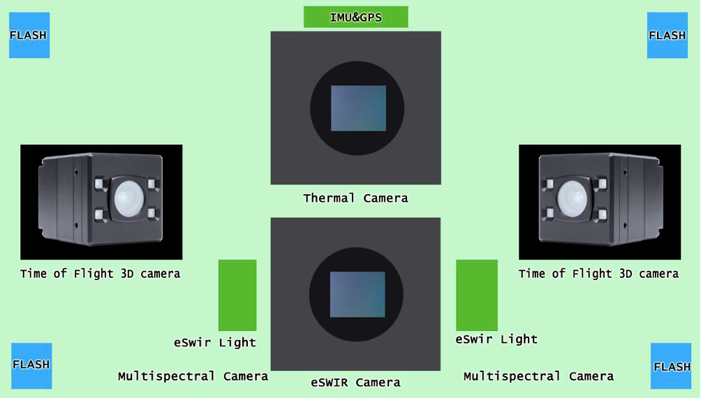 Figura 1 – Il sistema Steadypick
La partnership del progetto è composta da:
- Profilocolore Srl
- T-Connect Srl
- GAP Srl Gestione Archiviazione Prodotti
- Dipartimento di Economia e Impresa (DEIM) – Università della Tuscia (UNITUS)
FINALITA’ DEL PROGETTO
La finalità del progetto è quello di sviluppare un sistema integrato di ripresa portatile in grado di acquisire e processare:
- misura delle componenti di riflettanza spettrale delle superfici nella banda dai 300 ai 1000 nanometri in 7 bande;
- misura della componente di riflettanza spettrale nella banda 900-1700 nanometri, specifica per rilevare disegni sottostanti di preparazione e soggetti sovrapposti (pentimenti)
- misura colorimetrica ad elevata precisione secondo gli standard CIE derivata da misura radiometrica su 6 bande nel visibile
- modello tridimensionale e fotogrammetria
- immagine termica
- immagine in fluorescenza
A tal fine, SteadyPick prevede l’utilizzo combinato di più fotocamere, e di un sistema di illuminazione in grado di garantire la corretta acquisizione dei dati a tutte le lunghezze d’onda. Infine, un sistema di riferimenti metrici e radiometrici mobili completerà l’hardware del sistema.
Quanto al software, il progetto svilupperà un software dedicato per la calibrazione e il processamento delle immagini, equipaggiato con tutte le funzioni necessarie per l’impiego negli scenari d’uso ipotizzati.
RISULTATI DEL PROGETTO (aggiornato al 8 aprile 2021)
E’ stata completata la fase di analisi dello scenario del progetto e dei requisiti. Sono in fase di sviluppo le componenti tecniche del sistema (sia hardware che software) ed è da poco iniziata la fase di testing delle prime funzionalità.
SOSTEGNO FINANZIARIO RICEVUTO
Il budget totale del progetto è di 556.509,53 €, la sovvenzione concessa è di 408.403,74 €.
LINK PER LE PAGINE ISTITUZIONALI DEI SOGGETTI FINANZIATORI
Unione Europea
https://europa.eu/european-union/index_it
Fondo FESR Unione Europea
https://ec.europa.eu/regional_policy/it/funding/erdf/
Programma Operativo POR LAZIO FESR 2014-2020

Zerok-IRS 28 Jan 2019 6:08 AM (6 years ago)
![]()
Project acronym: Zerok-IRS
Project full title: Zero-Kilometer Items Routing System
Duration: 24 months – On going
Funding Scheme: POR CALABRIA FESR-FSE 2014-2020 ASSE I – PROMOZIONE DELLA RICERCA E DELL’INNOVAZIONE
Goals: Zerok-IRS apply the concept of “leagility” (intended as a combination of “lean thinking” and “agile manufacturing”) to regional logistics of the publishing sector exploiting the advantages and innovative elements of the Next Generation Information and Communication Technologies. This will result in a web platform consisting of two macro-systems: an highly innovative system of operational management and support for the decisions of the logistics operator and a virtual marketplace that will give citizens the opportunity to order and receive goods and products km-zero through a pioneering mechanism for content access and knowledge awareness. The platform can be browse in an intelligent, personalised, innovative way thanks to a personal voice assistant that can be used both by the professional operator and the final user of the marketplace, making the user experience more attracting than traditional systems.
Activities: T-Connect is the project coordinator and is involved in all the project tasks, from the requirement definition to the platform design and development, the platform testing and finally the results exploitation and dissemination.
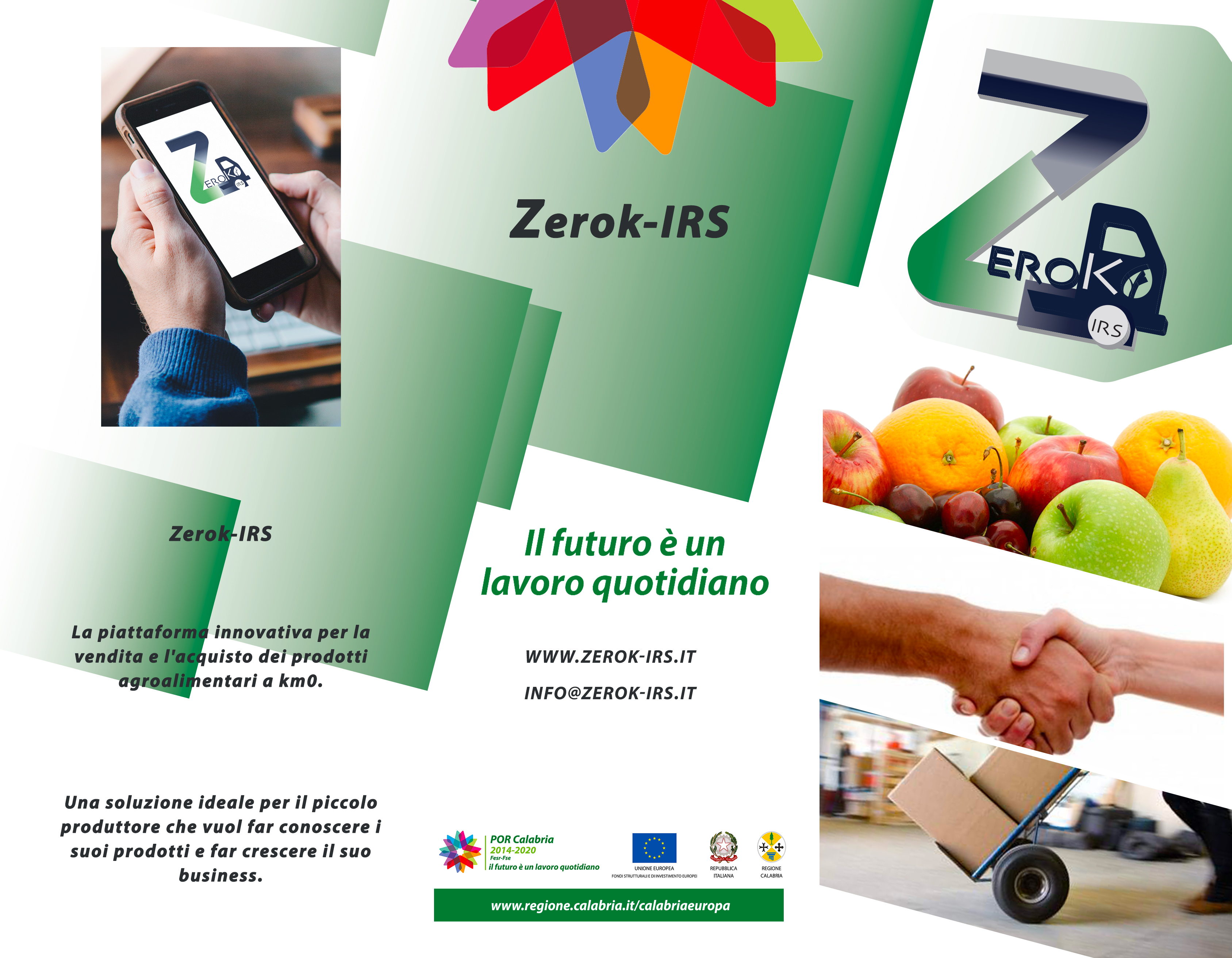
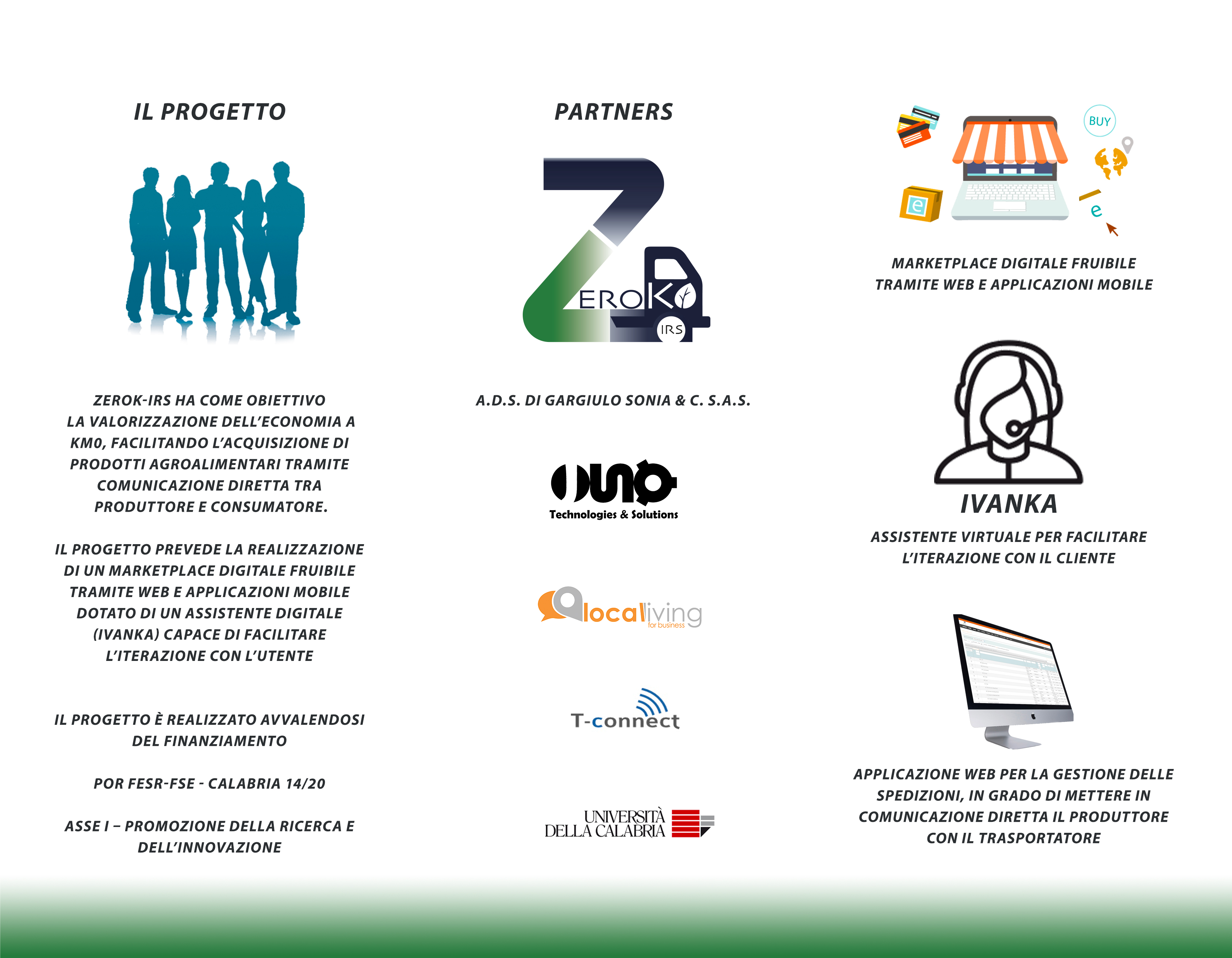
Brochure
SMARTRAIN 28 Jan 2019 6:02 AM (6 years ago)
Project acronym: SMARTRAIN
Project full title: Strumenti e Metodologie Avanzate basate sul Modeling & Simulation per il miglioramento e Rafforzamento del TRAINing nei terminal automobili.
Duration: 36 months – On going
Funding Scheme: Fondo per la Crescita Sostenibile –Bando “HORIZON 2020” PON I&C 2014-2020
Goals: The project’s goal is the prototype development, testing and validation of an advanced simulator architecture (SMARTRAIN simulators) which are interoperable and reusable for the training of operators (drivers) involved in the port terminals for vehicle handling.
Activities: T-Connect main task is the integration of the software simulator with hardware peripherals, in order to create realistic simulation stations. The aim is to create a real cave, that is an immersive station equipped with all the instruments that allows the operator to increase the sense of realism as close as possible to the real environment.
T-Connect selected as SME incubator the for project “App on” 3 Nov 2014 2:30 AM (10 years ago)
T-Connect has been selected as SME incubator for the project “App on” (started on March 20 2014), funded by the call “Creativi Digitali” (European funds POR FESR Lazio 2007-2013) and promoted by Regione Lazio via FILAS.
Official pages:
http://www.regione.lazio.it/europaimprese/startup/app-on.php
http://www.filas.it/Page.aspx?IDPage=328
Traffic Shaper 8 Apr 2014 6:32 AM (11 years ago)

Project acronym: Traffic Shaper
Project full title: Traffic Shaper
Duration: 24 months – Completed
Programme: Project co-funded by the European Commission and the CIP EMMIA Programme
Goals: The Traffic Shaper is a server-side platform and a mobile application to support enhanced mobility of drivers and daily commuters by allowing multiple travel route choices that take into account detected and predicted traffic jams. With Traffic Shaper, the shaping of the road vehicular flow will be done by merging and analyzing route requests with the historic and live road traffic conditions, and by homogeneously distributing the flow among alternative routes, all in order to mitigate the traffic jam issues as well as the drivers safety or air pollution issues.
The two-year Traffic Shaper project involves five European Partners, that all contribute their specific expertise and skills in the fields of the project. The Consortium includes:
- ANCI Umbria – Regional Organisation (Italy)
- T-Connect d.o.o. – Mobile application solutions provider (Slovenia)
- INNOVA s.p.a. – Innovation & Technology Consulting (Italy)
- ENCADRE – European Network of Clusters for satellite Applications Development in Regions of Europe – Technical (France)
- CFLI – Consortium for the Intermodal and Logistics Training Centre (Italy)
Activities: Application Construction,Backend system development, Mobile application development
UrbanSensing 24 Feb 2014 8:08 AM (11 years ago)
![]()
Project acronym: UrbanSensing
Project full title: UrbanSensing
Project site: urban-sensing.eu
Duration: 24 months – Completed
Programme: 7th Framework Programme – Capacities programme
Type of project: Research for the Benefits of SMEs
Goals: The ✳UrbanSensing project will bring a new product to the urban design, city planning and urban management market: a platform extracting patterns of use and citizens’ perceptions related or concerning city spaces, through robust analysis of User Generated Content (UGC) shared by the city users and inhabitants over social networks and digital media. The platform will allow to analyze users’ perceptions related to specific geographic areas and understand how population reacts to new urban policies within participatory mechanisms. It also gives insight in the lack of structures offered by institutions and city administrations and propose interventions, also within collaborative frameworks and to discover possible emergent structures and bottom-up initiatives responding to uncovered needs and desires. Next to this it will help to understand how specific user groups use public spaces and for instance, identify locations suitable for design interventions.
The two-year ✳UrbanSensing project involves six European Partners, that all contribute their specific expertise and skills in the fields of the project. The Consortium includes 3 SMEs:
- Accurat (Italy)
- LUST (Netherlands)
- Mobivery (Spain)
and 3 Research Performers:
- T-Connect (Italy)
- IT4all (France)
- Technical University of Kosice (Slovakia)
The tools and services provided by Urban Sensing will support the SMEs involved in the consortium in their decision-making processes through a set of personalization of the platform in three main information domains:
- Urban Policy assessment (Accurat)
- Communication, Exhibitions, Events assessment (LUST).
- Public transportation, commuting assessment (Mobivery)
Activities: Project coordination, support for architectural definition, design and development of the UGC collectors, UI development.
Dissemination: Area Magazine (Trieste Area Science Park) – Urban Sensing: studiare le dinamiche delle città coi social (Corriere.it)
Zoomarine App 12 Sep 2013 6:50 AM (12 years ago)
 T-Connect developed the Zoomarine App for Androide device. The App is now available in the GOOGLE Play Store and soon it will be also available, for iOS devices, in iTunes.The Zoomarine App work in 2 different modalities:
- Inside the park, visitors could check their positions and find their friends in the park to play with the them using the several games available
- Outside the park, to be updated about the news of the park the price of the tickets and the attraction available
The App provides an interactive map suitable to find easily the several services available in the park and it assures to the visitors to be continuously informed about what is happening in the park. Moreover the App provides the opportunity to create groups among visitors in order to keep them always in contact.
T-Connect releases Zoomarine App 12 Sep 2013 6:11 AM (12 years ago)
 T-Connect developed the Zoomarine App for Android device. The App is now available in the GOOGLE Play Store and soon it will be also available, for iOS devices, in iTunes.The Zoomarine App works in 2 different modalities:
- Inside the park, visitors could check their positions and find their friends in the park to play with the them using the several games available
- Outside the park, to be updated about the news of the park the price of the tickets and the attraction available
The App provides an interactive map suitable to find easily the several services available in the park and it assures to the visitors to be continuously informed about what is happening in the park. Moreover the App provides the opportunity to create groups among visitors in order to keep them always in contact.
![]()
![]()
CAMMEO Demonstration Video Online 26 Mar 2012 11:36 PM (13 years ago)
Watch our demonstration video about the last development in CAMMEO.