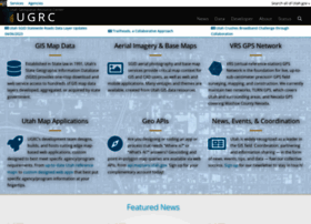
Utah - gis.utah.gov - Utah Mapping Portal

General Information:
Latest News:
Newest updates to Municipal Boundaries 10 Aug 2013 | 02:40 am
Updates were made recently to the SGID10.BOUNDARIES.Municipalities feature classes that reside on the Utah SGID ArcSDE database server The following highlights what has been updated through Aug. 9, 20...
Utah SGID Statewide Roads Layer Updates 8/1/2013 2 Aug 2013 | 01:02 am
Updates were made recently to the SGID10.Transportation.Roads feature class that resides on the Utah SGID ArcSDE database server. The updated Roads data is also available as shapefiles and file geodat...
AGRC Web Mapping Services Demo 15 Jul 2013 | 10:31 pm
AGRC Web Mapping Services AGRC offers a variety of mapping-related web services that make it easy to add authoritative Utah web maps to your applications. The two most popular are our base maps and ge...
AGRC Base Map Services Now Accessible via ArcGIS Online 10 Jul 2013 | 01:34 am
AGRC is beginning limited use of ESRI’s combination data portal and SaaS technology, ArcGIS Online (AGOL). Over the next few months, we will be experimenting with AGOL as an alternate/complementary ch...
Utah GIS Framework Data for 800 Please, Alex… 29 Jun 2013 | 04:00 am
AT: “The answer Is.. ‘At almost a million points and growing, this new statewide data resource adds extra precision to address location.’” KJ: “What is Utah’s Statewide Address Point Dataset?” AT: “Co...
New Release of atlas.utah.gov 29 Jun 2013 | 01:18 am
AGRC recently released a new version of atlas.utah.gov, a map viewer that allows users to inspect the statewide base map services that highlight terrain, land ownership, aerial photography, etc. Addit...
Utah SGID Statewide Roads Layer Updates 6/5/2013 6 Jun 2013 | 04:15 am
Updates were made recently to the SGID10.Transportation.Roads feature class that resides on the Utah SGID ArcSDE database server. The updated Roads data is also available as shapefiles and file geodat...
Utah SGID Layer Updates 6 Jun 2013 | 01:47 am
AGRC has updated some layers in the State Geographic Information Database (SGID). The updates are a result of the work that’s been done for the Utah Broadband Project’s, Community Anchor Institutions ...
Utah Statewide Address Geocoding Web Service Upgrade 11 May 2013 | 01:22 am
Last week, AGRC finished a substantial upgrade to the Utah statewide address locator (geocoding) web service. This service utilizes point- and road-based address map reference, data compiled into the ...
First quarter Municipal Boundaries updates 29 Apr 2013 | 08:13 pm
Updates were made recently to the SGID10.BOUNDARIES.Municipalities feature classes that reside on the Utah SGID ArcSDE database server. The updated Municipalities data is also available as shapefiles ...

